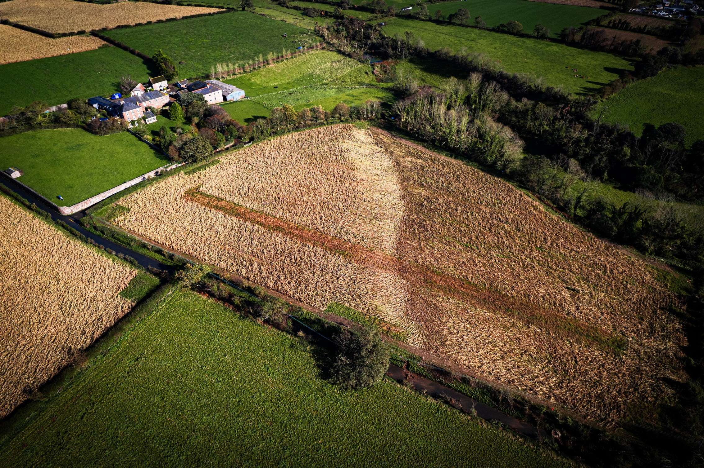
A DRONE photographer has captured an image showing the path the tornado took as it ripped through parts of the Island during Storm Ciarán.
The twister has been graded a T6 – making it the most powerful to hit the British Isles for almost 70 years.
The tornado made landfall in St Clement before tracking north-east, causing major damage to properties around the FB Fields, Boulivot and Fliquet.
Several people have been made homeless.
The image, taken by Philip Clyde-Smith, shows how the tornado cut through a field in Grouville, narrowly missing properties.


