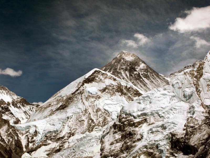
Mount Everest is around 15 to 50 metres taller than it would otherwise be because of a river that is pushing it up, research suggests.
The nearby river is cutting into the landscape around the mountain and pushing the giant peak further upwards.
Erosion from a river network about 75 kilometres from the mountain is carving away a substantial gorge, causing it to rise up by as much as two millimetres a year.
Over the past 89,000 years, this has increased Everest’s height by between 15 and 50 metres, researchers say.
“Our research shows that as the nearby river system cuts deeper, the loss of material is causing the mountain to spring further upwards.”
Lead author Dr Xu Han of China University of Geosciences, who carried out the work while on a China Scholarship Council research visit to UCL, said: “The changing height of Mount Everest really highlights the dynamic nature of the Earth’s surface.
“The interaction between the erosion of the Arun river and the upward pressure of the Earth’s mantle gives Mount Everest a boost, pushing it up higher than it would otherwise be.”
The tallest mountain on Earth, Mount Everest is 8,849 metres high, and rises about 250 metres above the next tallest peak in the Himalayas.
However, it is considered to be an anomaly, as the next three tallest peaks – K2, Kangchenjunga and Lhotse – all differ only by about 120 metres from each other.
This process causes a section of the Earth’s crust to float upwards because the intense pressure beneath the Earth is greater than the downward force of gravity.
Today, the Arun river runs to the east of Mount Everest and merges downstream with the larger Kosi river system.
Over millennia, the Arun has carved out a substantial gorge along its banks, washing away billions of tonnes of earth and sediment.
Co-author Dr Jin-Gen Dai, UCL Earth Sciences, said: “An interesting river system exists in the Everest region. The upstream Arun river flows east at high altitude with a flat valley.
“It then abruptly turns south as the Kosi river, dropping in elevation and becoming steeper. This unique topography, indicative of an unsteady state, likely relates to Everest’s extreme height.”
The uplift is not unique to Everest, and also affects neighbouring peaks including Lhotse and Makalu, the world’s fourth and fifth highest peaks respectively.
Co-author Dr Matthew Fox, of UCL Earth Sciences, said: “Mount Everest and its neighbouring peaks are growing because the isostatic rebound is raising them up faster than erosion is wearing them down.
“We can see them growing by about two millimetres a year using GPS instruments and now we have a better understanding of what’s driving it.”
The study, published in the Nature Geoscience journal, looked at the erosion rates of the Arun, the Kosi and other rivers in the region.
The researchers were able to determine that about 89,000 years ago the Arun river joined and merged with the Kosi river network, causing more water to be funnelled through the Kosi river, increasing its erosive power.
With more of the land washed away, it triggered an increased rate of uplift, pushing the mountains’ peaks higher.