Historian Doug Ford continues his celebration of our coastline
LYING below La Coupe to the west is
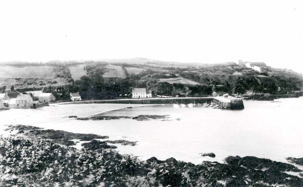
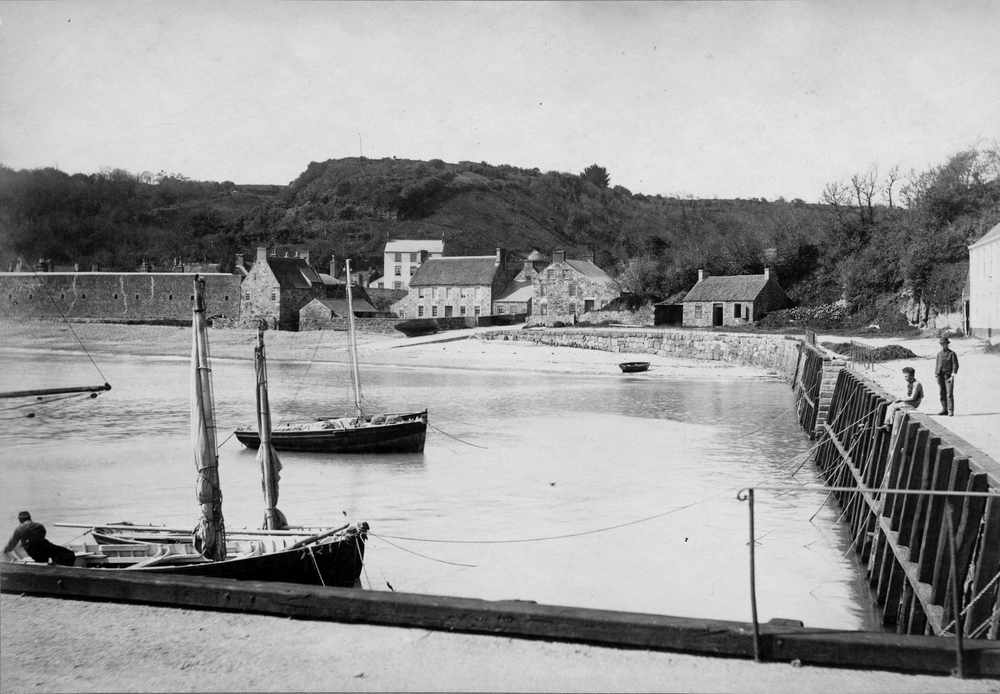
Le Saie Harbour – Le Scez in Jèrriais – which means a harbour in the sense of a sheltered anchorage.
Le Saie had obviously been used by fishermen for a long time as stone alignments of ancient fish traps can still be seen among the inter-tidal rocks and the Assize Rolls record the theft of a boat there in 1299. Although, if the winds move into the north then any vessel anchored there would be in danger, as was the case in October 1896 when the 17-ton cutter Iris dragged her anchor and was wrecked. Thirty-eight years earlier the Iris, crewed by seven men from Rozel, had been involved in the rescue of the French sloop Goéland from among the rocks of the Ecréhous.
The slipway leading onto the shore was built to allow farmers to collect vraic.
‘About half a league to the north west (of St Catherine) is a small creek, called Rosel, where the Islanders keep several boats, both for fishing and for going to the Ecréhous, there to fetch such seaweed, as they burn, and manure their land with’ … the leading marks for the harbour were ‘…the two chimneys of the northernmost house upon that harbour one by the other’
Philippe Dumaresq, Survey of the Island of Jersey, 1685
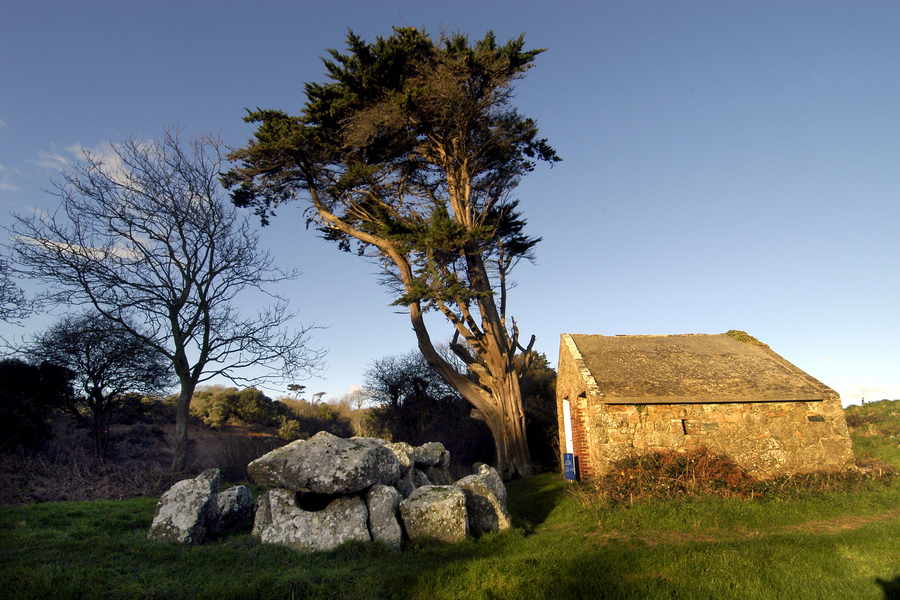
In 1689 a guardhouse was built to support a gun position on Le Couperon, the headland that separates Le Saie and Rozel Bay. It was rebuilt in 1778 with the local stone – Rozel conglomerate sometimes referred to as pudding stone – which looks like badly made concrete. During the French Revolutionary Wars two 12-pounder (later 24-pounder) guns were set up here. The guardhouse can still be seen today standing next to Le Couperon Dolmen.
The track that leads up to Mont de Rozel from the dolmen is called La Rue des Fontonelles, which indicates that there were springs in the area, one of which gave its name to the inlet La Douet de la Mer.
Early days
In 1834 Henry Inglis described Rozel as ‘one of, if not the sweetest bays of Jersey’ in the first serious guide book to the islands which was aptly called The Channel Islands.
Taking its name from the town of Rozel in Normandy where the first Seigneur of the fief came from, Rozel was described as a port as early as 1274 – although it would have simply been a landing place. The first port structures only appear in the 19th century despite the fact that during the English Civil War a Royalist ship was based here. Its main role, however, has been as a fishing harbour. In 1810 about six or eight small boats were based here but as the oyster fishery developed in the years following Waterloo numbers grew and by 1820 there were 30 vessels.
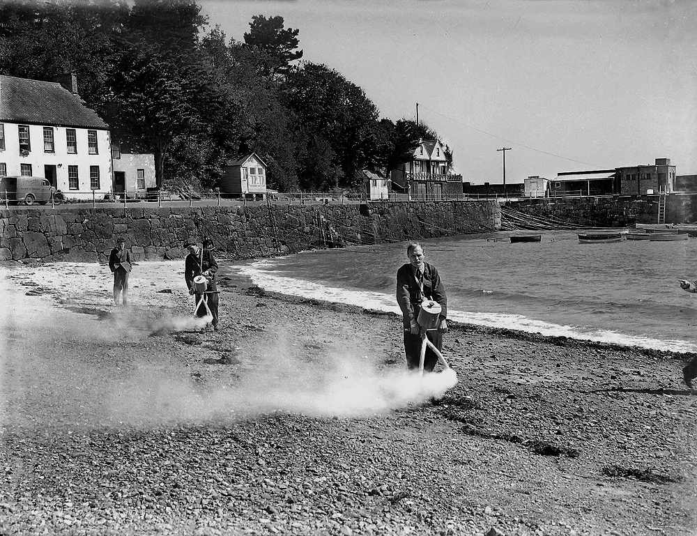
In 1824 the States agreed to build a quay and a pier. Philip Godfray won the contract and by 1830 the work was completed. Once the pier was built, fishermen’s cottages were constructed along the approach road. One of these has an unusual date stone above the front door. Dated 1832, the initials JRS and JLS are linked by a tilted ampersand rather than by the more usual hearts.
Shipping and fishing
In 1856 the register of the Oyster Fisheries shows that 17 of the Island’s oyster dredgers were based in Rozel. Within ten years the oyster industry was finished and so the fishermen either had to stick with the less lucrative local fishing or else go further afield dredging in the Channel around Barfleur. By 1871 two of the larger cutters were dredging in the Irish Sea.
In September 1854 a Royal Navy ‘Blackbird Patrol’ vessel stopped the Jersey-owned brig Newport on suspicion of being involved in the illegal slave trade.
Her master, Charles Philippe Hocquard of Rozel, was found guilty, the ship was confiscated and sold.
Over the centuries numerous vessels, both big and small have come to grief on the reefs to the north-east of Rozel – the Dirouilles and Ecréhous. Men from the bay were active in many rescues. One of the largest was on the night of 22/23 March 1816 when the French ship La Balance came to grief while on passage from Le Havre to St Malo. A large proportion of her 84 passengers were women and children, 35 of whom drowned before help arrived. The survivors were brought into Rozel where they were given food and shelter in the newly constructed Rozel Barracks by the men of the 8th Royal Veteran Battalion.
Of course, it wasn’t only at sea that people had accidents – on the evening of Monday 24 May 1874, a Mrs Cabot of Trinity was backing her horse and cart onto the pier when the cart went over the side dragging the horse and Mrs Cabot into the sea. Happily, some passers-by were able to extricate Mrs Cabot from the tangle but unfortunately the horse drowned.
Despite having no official lifeboat stationed here, Rozel does have its place in Jersey’s lifeboat history, for it was here that the Island’s first lifeboat had been built by a Mr Lillington, a shipwright from Weymouth, under the supervision of Captain Wiliam Symonds, RN. It was launched on 17 May 1830 and then sailed around to Havre des Pas where she was to be stationed. Rozel was also the first official job for the RNLB Howard D. as on 20 November 1937 she was called to pick up the master of the M.V. Affaric so that he could attend the inquest on one of his men who had died as a result of an accident at Ronez Quarry.
Defensive positions
Like all bays Rozel has its fair share of defensive positions, although the plan to build one of the Conway Towers here was abandoned when Archirondel ran over budget.
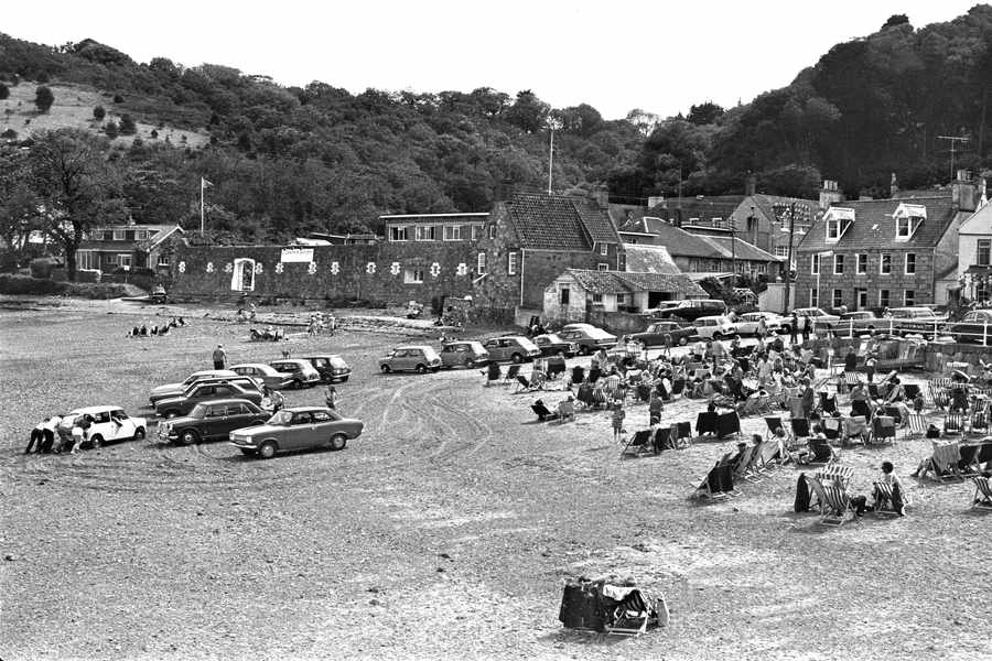
However, General Don did have a barracks for three officers and 65 men built here in 1809/10. Unfortunately, it was badly built and within four years the wall facing the sea had to be underpinned.
As well as soldiers and distressed sea travellers the barracks also played host twice to Lieutenant-Governors, their families and staff while remodelling work was undertaken at Government House in 1824 and again in 1861. The barracks were extended but eventually abandoned by the end of the century. In 1924, the War Department sold the barracks and the site was converted into a hotel and restaurant. Today they are private homes.
On either side of the barracks are slipways,
Le Brecque du Sud and Le Brecque du Nord. A brecque is a gap in a sea wall or embankment, which may indicate that, during the
18th century, the whole bay was protected by a sea wall.
The actual slipway was only built in 1862 as part of a contract that also saw the removal of rocks at the entrance to the harbour.
From the harbour a path leads up to Le Nez de Guet. Here the word ‘nez’ has nothing to do with the French word for a nose rather it means a headland from the Norse word ‘ness’ while ‘guet’ means ‘look-out’. So the name means ‘look-out point’.
A watch house was already built here in 1679, by the French Revolution two 24-pounders had been placed on the headland and in 1835 a small fort had been built armed with five 24-pounders and manned by 50 soldiers. It was also sold by the War Department in the early 1920s and is now a private residence.
