THE Channel Islands seem likely to escape any major impact from a former hurricane that is making its way across the Atlantic Ocean, Jersey Met has said.
The latest forecast yesterday afternoon showed that Storm Kirk will probably reach the west coast of France at some point tomorrow afternoon, bringing strong winds and heavy rain across a central swathe of the French mainland.
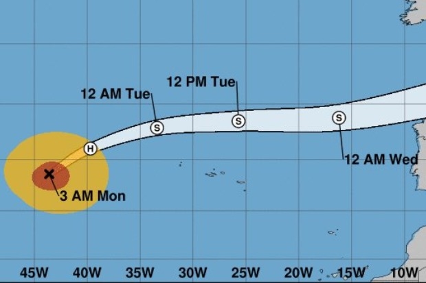
Senior forecaster John Searson said there was now a high degree of certainty about the storm’s path, following initial indications towards the end of last week that suggested Kirk might pass down the English Channel.
“It looks likely there could be 50 to 100 millimetres of rain in quite a large area of France, with a risk of significant flooding, but we will be at the northern edge, so it’s not likely to be anything substantial for Jersey,” he said.
Mr Searson explained that forecasters would be “keeping a close eye” on the situation and that any associated rain would be seen with showers tomorrow morning, potentially merging into more persistent wet weather during the afternoon and evening.
The forecast for later in the week indicates the showers could be more occasional on Thursday, with winds over the coming days of force four or five and maximum temperatures of 15°C or 16°C. A tracking map released by the National Oceanic and Atmospheric Administration in the US showed the probable path of the storm.