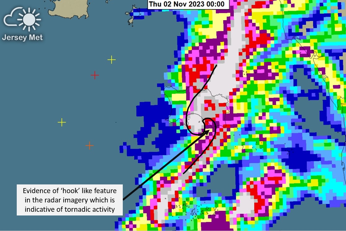
A TELL-tale “hook” on Jersey Met’s radar imagery is believed to have captured the moment the Storm Ciarán tornado hit the Island.
Numerous homes were damaged when the twister ripped through the FB Fields area of St Clement at about midnight on Wednesday.

The tornado, which some residents believe formed off the south coast and tracked in a north-easterly direction through St Clement, came out of an intense thunderstorm which pelted the Island with huge hail stones.
Jersey Met has since supplied the JEP with an image of the radar taken at the same time residents reported the tornado hitting their homes.

It shows a “hook” at the back edge of the band of rain and hail, indicating a twisting movement of air and moisture within the thunderstorm.
Matt Winter, senior meteorologist manager at Jersey Met, confirmed that “all the ingredients were there” for a tornado to form.
He added: “We are pretty certain that there was a tornadic feature. There was an intense thunderstorm going through with large hail and with such strong winds it wouldn’t take much to create the rotation needed for a tornado to form.
“The radar also shows a classic hook, which is indicative of a tornadic feature.”


