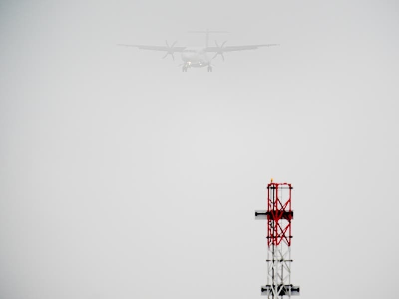
Disruption caused by thick fog is expected to continue until Sunday at some of the UK’s busiest airports.
Flights at Stansted Airport were affected by the weather conditions on Saturday, while live departure boards showed delays at Heathrow, Luton and Manchester airports.
Nats, the UK’s main air traffic control provider, said temporary air restrictions would remain in place until Sunday in areas with low visibility.
Patches of thick fog could reduce visibility to just 100 metres in some areas, the Met Office said, as passengers have been advised to contact their airlines for updated information.
A Nats spokesperson said: “Restrictions of this sort are only ever applied to maintain safety.
“We continue to monitor the situation and have a Met Office expert embedded within our operation to ensure we have the latest available information.”

Kiera Quayle, from Colchester, Essex, was due to fly from Isle of Man Airport to Gatwick on Friday evening with her husband after visiting his family but their flight was delayed by three hours before being cancelled entirely at around 10pm, with their next available journey on Sunday.
“Our five days has turned to seven, it looks like,” Ms Quayle, 30, told the PA news agency.
“It’s frustrating and stressful but I overheard a few families who are now missing holidays and work who have it worse at this point.”
Remaining cloudy this evening with patchy drizzle, mist and fog across England and Wales
Outbreaks of rain across Scotland and Northern Ireland continuing to move southeastwards with a mix of clear spells and showers following pic.twitter.com/g6DcFLuxVW
— Met Office (@metoffice) December 28, 2024
Passengers on flights delayed for more than two hours may be entitled to assistance, including food and drink or overnight accommodation if necessary, an expert from consumer website Which? said.
Jo Rhodes, Which? travel expert, said: “If your flight is cancelled, you also have the choice of being refunded or rerouted on the next available flight.
“If you choose the latter, then your airline must get you to your destination as soon as possible – including with a rival carrier, if necessary.
“Airlines can sometimes be reluctant to buy you a ticket with their competitors, so don’t be afraid to remind them of this rule if another flight could get you where you need to go quicker than they can.”
The Met Office advised travellers to allow “a little bit longer” for journeys and warned drivers to leave extra braking distances in areas with poor visibility.

“Tonight, we should start to see a little bit more in the way of breeze developing, so that should start to disperse some of the poorer visibilities across the rest of the UK,” he said.
“So we might start to see some of the fog and low cloud begin to lift as the night goes on, but generally with plenty of cloud around we’re not really expecting any issues with frost or anything like that.”
On Sunday, south-east England could have a “dull start” which is expected to brighten with highs of 12C predicted, he added.
Towards New Year’s Eve, the forecast is looking “unsettled” with blustery and wet conditions hitting the north of the UK and “less expansive” rain in the south.
The Met Office issued a yellow weather warning for snow and rain in Scotland next week, warning that heavy downpours may bring “significant disruption” in the build-up to Hogmanay.
⚠️ Yellow weather warning issued ⚠️
Strong winds across northern England
Monday 1100 – 1800
Latest info ? https://t.co/QwDLMfRBfs pic.twitter.com/f87S7JGxti
— Met Office (@metoffice) December 28, 2024
The alert is in place for most of Scotland, apart from Orkney and Shetland, on December 30 and 31 during which 50-70mm of rain is possible, with up to 140mm in the west.
Snow is likely in areas north and east of Perthshire, with between 10 and 20cm expected to accumulate on higher ground, according to the forecaster.
A yellow weather warning for wind in northern England on Monday has also been issued – with gusts of up to 60mph possible which may cause travel delays and power cuts.
The warning, in place from 11am to 6pm, covers areas including Durham, Northumberland, Cumbria and North Yorkshire.


