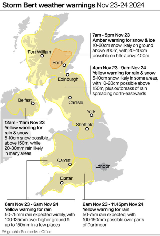
Hundreds of schools are closed amid snowy conditions and an amber weather alert has been issued for the weekend when Storm Bert is set to sweep in.
The Met Office said Storm Bert is expected to bring “heavy rain, strong winds and disruptive snow to parts of the UK through the weekend” and warned of travel disruption and potential flooding.

Forecasters said power cuts and travel disruption are likely and there is a good chance some rural communities could become cut off.
A yellow warning of snow and ice for much of Scotland, northern England and parts of western and eastern England and Wales is in force between midday on Thursday and 10am on Friday.
The wintry weather has affected education with more than 114 schools shut in the Highland Council area on Thursday due to snow, including Inverness Royal Academy where pupils were told their prelim exams planned for the day will be rescheduled.
Almost 40 schools in Aberdeenshire are also shut while many others had delayed openings, and in Moray around 12 are closed and others opened late.

South of the border, 89 schools are shut in Devon on Thursday, 18 in Dorset and 60 in Cornwall, while in Wales around 10 are closed in Conwy, 18 in Denbighshire and two in Wrexham.
The weather has also caused transport disruption, with Stagecoach Highland services in Inverness suspended due to road conditions and Stagecoach Bluebird services in Moray disrupted.
Parts of south-west England including Plymouth and Exeter are under a yellow warning for snow until 3pm on Thursday, with 5-10cm predicted in higher parts of Dartmoor.
Forecasters said Storm Bert will reach the UK on Saturday, bringing heavy rain and snow, together with strong winds to large swathes of the country.
Ahead of the storm, wintry showers will continue to impact parts of the UK on Thursday and Friday, particularly exposed areas in the north.

“Heavy rain through Saturday and Sunday, especially in southern and western parts of the UK, will also bring impacts for some with a number of warnings in place.
“We expect 50-75mm of rainfall quite widely within the warning areas, but in excess of 100mm is possible over high ground in parts of Wales and south-west England.
“In addition, rapid melting of lying snow over the weekend and periods of strong winds are likely to exacerbate impacts and bring the potential for travel disruption, as well as flooding for some.”

There is already a yellow warning for heavy snow on Saturday followed by a “rapid thaw” and rain on Saturday night in north-east and north-west England, the West Midlands, Yorkshire, and much of Scotland.
The RAC urged people to take care on the roads.
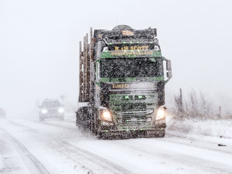
RAC Breakdown spokeswoman Alice Simpson said: “The first taste of winter means drivers are suddenly contending with the some of the worst road conditions we’ve seen all year.
“With freezing temperatures already causing disruption in the east and north of England, Wales, Scotland and Northern Ireland, and snow showers now affecting regions further south, we advise motorists to plan well as ice forms on untreated surfaces.”
Scotland’s transport agency, Transport Scotland, said the amber warning means roads could be affected by deep snow and “some rural communities might be cut off”.
It also warned of potential delays and cancellations to trains and buses and of power cuts and phone outages.
Scottish Transport Secretary Fiona Hyslop said: “The conditions will likely cause difficult driving conditions and disruption to the wider transport network, so it’s important that anyone that has to travel during the warning period plans their journey ahead of time.”


