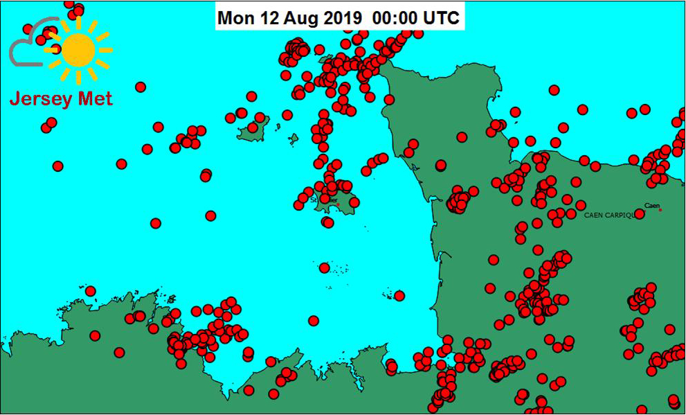
Car and burglar alarms rang out in the early hours as a thunderstorm swept across the Island.
Between 2am and 3am alone, 8.8mm of rain fell in St Helier, with a total of 12.4mm falling during the rest of the storm. A further 3mm fell during the morning as more showers – and a number of funnel clouds – passed over the Island.
And the bad news for parents trying to find things to entertain children in the school holidays is that the unsettled weather is due to continue during the rest of the week and weekend, and into early next week.
Matt Winter, duty forecaster for Jersey Met, said: ‘This time of year, a lot of our rainfall does come from showers and the nature of showers is that rain falls in quite a short period of time,’ he said.
‘The mean average for total rainfall in August is 51.3mm, so in the context of that, it is over a quarter of that rainfall in 24 hours.
‘It does put us about half-way through the rainfall that we would expect in total for this month – so we have recorded over 50 per cent of the month’s average total rainfall, so far.’
Commenting on the forecast for the coming days, he said: ‘I suspect that we are looking at more unsettled weather for the next week or so, so I suspect those rainfall totals will start to tot-up.
‘We cannot see particularly too far with any certainty but we are pretty confident that much of the next six to seven days is looking pretty unsettled with further periods of showers or rain at times.
‘Temperatures will be around what we should be for this time of year and slightly below that on other days. It is just looking rather unsettled.’
The UK Met Office, which issues long-range forecasts on its website, is forecasting the generally unsettled weather to continue for much of the rest of the month.
It states: ‘The unsettled theme looks set to continue through this weekend, with low pressure systems affecting the UK. This is likely to bring spells of rain, which could be heavy at times.
‘These will be interspersed by brighter and showery interludes across the UK. It will be windy too, with gales at times, especially in the north and west. Any drier spells are likely to be brief through this period.
‘Into next week and towards the end of August, there are some signs that longer drier and more settled spells may occur, especially in the south. Temperatures will often be below normal for the time of year, and there will be some chilly nights.’
FIVE-DAY FORECAST: CLICK HERE